Just another WordPress.com site

We discovered just why our hotel had been so cheap. The rooms were small and the sound proofing practically non existent. The room next door had a young family, with a baby at the teething stage, waking (us as well) up every hour or so and the parents relying on the TV (too loud) to induce sleep again. I used my iPod to provide music to block out the noise, but Cliff had a bad night.

We had decided to move on to Puquio that according to the map was ‘just’ 128 km away. Wrong, a sign post out of Nazca said 155 and proved to be correct. This had not been a fast road yesterday, as it twisted and turned up the mountains, although it did provide some glorious views. Being Sunday, there was little traffic around. Unfortunately Cliff’s bad night was catching up with him and affecting his digestive system (or vice versa), so that we made another stop at yesterday’s S1165, with Cliff leaving a deposit rather than taking pictures this time. I took some pictures of Tillandsia that I had missed yesterday.

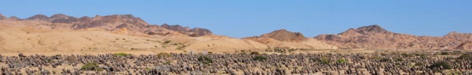
Cliff really was not well enough to do our usual cactus stop walks, so we limited ourselves to some quick dashes out of the car to take pictures of cactus species that we had not seen before. At km 45 (S1166) we saw a huge Armatocereus – the sprawling type, that we had also seen earlier in the Pisco Valley. That day, rain stopped play and today there were very dark skies above where we were heading. Cumulopuntia sphaerica put in an appearance, but nowhere near as dense as it had been in Chile and Argentina.

The road rapidly deteriorated and it became a sport to miss all the pot holes. ‘Perhaps I should aim for them. If my success rate for that is as good as for missing them, we should have a smoother ride’ I suggested. ‘I thought that you were aiming for them.’ came Cliff’s reply, indicating that he was feeling marginally better.

By S1167 we had climbed to 3,577 m. and the Browningia had disappeared. We wondered if this meant that Oreocereus would soon take over and this stop confirmed that it does. The Database suggests that we should call this O. leucotrichus fa ritteri and it certainly fits into the concept of O. leucotrichus that we saw in northern Chile, where it also took over from Browningia candelaris. But were as the fruits of O.leucotrichus appear to release their seeds through a basal pore, the fruits here seemed to split along the side of the fruit. We later discussed the feature with Paul Hoxey who confirmed this and believes that this justifies the repositioning of the taxon as a good species in its own right.

There was also another ceroid here and more for the record than for any other reason, I took its picture too. Looking at the images on the laptop and zooming in on the buds make me feel sorry that I did not pay more attention. You’d swear that this was an Eulychnia acida fa in bud! Now that would be a novelty! In Chile we also Corryocactus brevistylus growing alongside the Oreocereus. Putting this stop data into Google Earth and The Data Base records with GPS data tell me that C. brevistylus does grow here and that I should have found Matucana haynei fa hystrix here as well. I’ll do better next time, promise.

Just before Puquio we passed through Lucanas, but Cliff was not up to any more exploring, just wanted to get some sleep, instead of having his bones rattled on the road. Planted along the road was Austrocylindropuntia subulata (ssp. exaltata is suggested by The Database, but it doesn’t look like what was grown under that name at Holly Gate. This looks like straight forward A. subulata to me). And there was also an Echinopsis (Trichocereus) growing along the road, for which the name E. puquiensis is suggested, although I have no idea what the NCL calls it. It looks similar to what we saw around Cuzco last year and called E. cuzcoensis. [PK PS: The NCL records E. puquiensis as a synonym of E. cuzcoensis.]

As we approached Puquio, the sky had turned ink black and we arrived in town driving through a river rather than the road. We found rooms in the aptly named Hostal Maverick, where we were given a room on the 4th floor, even though we were unable to detect any other guests. Cliff went straight to  bed, giving me a chance to write up 2 day’s worth of Diaries, but unfortunately again there is no Internet in the hotel and the rain makes it very unattractive to find an internet cafe in town. We’ll do better once we reach Cuzco, where everything is much more tourist focussed.

PS Interesting night as the hotel seems to have a dual purpose and the Peruvians are rehearsing for the Olympic Bonking event. Once again, the iPod blanked out the noise, but Cliff again claims a sleepless night – although he does snore a lot for someone who can’t sleep.

So do you spell Nazca with a ‘z’ or ‘s’; and the same question for Cuzco? Both spellings are seen, with a ‘z’ at the toll booth, but with an ‘s’ on the sign entering the town. I just love consistency.

We started the day with a walk around the Plaza at Pisco (always spelled with an ‘s’, unless you are pizzed) to take some more pictures of the earthquake damage. This was even more poignant since we realised that the empty space next to the damaged town hall was the space where the cathedral had stood and where many people died. It seems that the decision to rebuild or not lies in Rome, with the Pope, so don’t hold your breath. It made me realise that when you hear on the news about such disasters, the affect on the people carries on for years, while the news-machine turns its attention to the next disaster. And also, that although the news may report an earthquake near the better known town, hundreds of people living in small villages are equally affected for years to come. A very humbling experience.

We fought our way through a stream of ‘put-put’ motorbike taxis (giving the place an Asian feel) to get to R1S (not R15 as reported yesterday), the Pan American highway, and headed south, turning inland at Ica. The coastal area is heavily developed for agriculture, an activity that here may date back to pre-Inca days. Crops include grapes, corn and cotton. Past Ica, we hit the ‘desert proper’, sand as far as the eye could see, with here and there some failed projects, and others doomed to fail, like a row of Opuntia ficus-indica pads planted in the sand with what looked like an irrigation hose alongside it. I guess that the folk in charge of the tap had gone on holiday, as most of the pads looked to have given up the ghost.

We passed the signs for the famous Nazca lines. I suggest that if you do not know about this World Heritage feature, you run a quick search on Google. Fascinating stuff, but nothing to see on the ground, so you need to fly over the area (on a clear day – this is a fog zone!) to observe the human endeavour dating back to a time when there were no planes.   

We arrived in Nazca in good time and by 14:00 had booked ourselves into a cheap hotel and were back on the road, heading inland, up the Nazca (?) Valley. The wifi they had promised at the hotel later proved to be non existent, but at the equivalent of GBP 8 for the two of us for one night, wifi was perhaps a little too much to expect. So what did this valley in store?

S1163, at km 14.75, had ample cacti on display: Neoraimondea arequipensis, some in pristine condition, some ‘wrecked’; Armatocereus procerus, Melocactus peruvianus (in flower and in fruit), Cleistocactus hystrix. A bit farther along, at km 24.3 (S1164) we found Weberbauerocereus rauhii, a very variable species in terms of the colour of spination, unless there were more taxa here that we failed to recognise. All the plants from the previous stop were here as well. Although we had only driven 10 km, we had climbed 1200 m. to 2,039 m. altitude! [checking later, the real altitude was only some 1,500 m. after the GPS had settled down, confirmed by Google Earth, still a climb of some 700 m. ].

We also found a shrub / tree here that seemed to be coming just into leaf and flower. The spine like hairs on its new growth made the alarm go off in my head – Jatropha, of the stinging variety. I warned Cliff, who got stung anyway.

We made one more stop S1165, at km 36 to take pictures of Browningia candilaris and Neoraimondia arequipensis together. The waxy epidermis of the Neoraimondia seems too great a temptation for tourists, who have to carve their initials, or there name and even it seems their life story onto the stems. On the plus side, it seems that some of these messages date back to 1963, providing an indication to the age of the plant.

We drove back to Nazca, had a stroll around town and had dinner.

While writing up the notes at the end of the day, a reality check indicated that with a 240 km per day limit imposed by Budget Rent a Car  (Peru) and a US$ 0.50 per km excess charge, we were currently facing a US$ 91 dollars surcharge. Going up and back down a valley as we had been doing is nice, but not distance efficient, so we’re looking at maps and rejigging plans.   We also want to be in Arequipa on 18 January, when Paul Hoxey is due to arrive as we’ve promised to buy him a beer.

No, ‘Up the Pisco Valley’ is not a variation on the question ‘Are you up for a piss up’, but after a few days of cactus-less photography it was time to put on our cactus explorer’s costumes and head into the hills in search of Peruvian cacti. And not a bad start for the first full day.

Let me start by explaining that the coastal strip here in Peru is quite different to that in Chile, where the Coastal Cordilleras often come almost straight out of the Ocean and can stretch for many km. inland, acting as a fog & cloud catcher, preventing humid air from reaching the plain farther inland. There is a similar ‘water shadow’ in the east, preventing moist air from the Atlantic Ocean & Brazilian rainforests to penetrate. The really dry bit in between these mountains is the true Atacama Desert.

In Peru, the coastal mountains are missing and there is a broad plain, around 30 – 50 km wide around Pisco, before you reach the Andean foothills. Travel up into these hills and eventually you reach the Altiplano, the high plains, that receive quite a bit of rainfall during their summer months of late December, January and February, as Angie & I discovered last year at Machu Picchu, that we saw, dressed in plastic rainwear, through clouds.  

The coastal plain is often a stretch of apparent sand dunes, without obvious vegetation as you speed through it on the Pan Am (here called Ruta 1S) at 100 km p h. But there are many more Quebradas with water flows from the Andes that cross the plain and empty into the Ocean. In Chile, many such streams dry up in the Atacama Desert, stopped by the coastal mountains from reaching the Ocean. Few get through, such as the R. Chopa, R. Limari, R. Elqui, R. Huasco and R. Copiapo.  It is these river systems that influence the diversity in cacti and other vegetation.

The Peruvian Quebradas create oases that have been exploited by human endeavours for centuries, particularly by the Incas, by building extensive irrigation systems, so that these valleys become the centre of agriculture. It was impressive to see the stark contrast between the lush green Pisco Valley and the barren mountains that rise up behind them, as though someone had drawn a line: ‘no vegetation beyond here!’

As we entered the mountains, there was just a narrow band of vegetation, due to the irrigation and used for agriculture. The road we followed was the main Pisco to Ayacucho road. At about km 56 we were beginning to ask ourselves: ‘So where are the cacti?’ as we expected tall (ceroid) cacti to appear on the hillsides, and if by magic, there they were, around the next bend. Tall thin stems that from a distance look as though someone had tied string around the stem, dividing them into (annual growth?) sections.

It took some time before we found a ‘parking place’, some where that allowed us to pull the car off the road and get access to the cacti without having to use mountaineering ropes etc. We succeeded around km 70 (S1158) and Wow!!!

On our gently sloping hill side we found the following cacti, in order of ease of identification:

  •  Neoraimondea arequipensis ssp roseiflora
    What a strange plant, with areoles (the bits where the spines grow, for the non cactophile audience) that carry on growing. They give the impression of being not too tall, but stems get to 2 m (7 ft) and the many stems that offset from the base form a giant from close up.
    Got some nice pictures against a ‘blue-with-white-fluffy-clouds’ sky.

  • Armatocereus procerus
    This is the tall thing with growth sections on the thin upright stems. They get to 3 m (10ft) tall and sway alarmingly in the wind.

  • Melocactus peruviana
    There were a number of dead globular plants and some young, live seedlings around and once we found a mature plant, alive and with cephalium, the ID was easy, as there is only one Melocactus sp. from this part of Peru.

  • Cleistocactus hystrix (syn. Loxanthocereus peculiaris)
    At least that is the name that no less a person than Graham Charles suggests when he lists plants from a stop just a km or so up the road. The stems crawl along the rocky slopes (upwards) and have cleistogamous flowers, so ….

  • Haageocereus acranthus
    Easily confused with stems of Cleistocactus, but flower and seed pods differ – much more robust than for Cleistocactus and flowers open (not that we saw any in flower, but judging by the flower remains) and fruits that we saw – no ripe seed, before you ask.

Haageocereus decumbens = syn. H. australis and Mila caespitosa are also reported from around here, but did our cameras see them? Some plants do look like Mila, but may just be young Haageocereus or Cleistocactus. Who knows.

We moved on to Huaytara and were attracted by the twin towers of its church to take a look around (S1159) the village. There were Agave (A. americana?) and Trichocereus around, but was the latter an escaped cultivated plant or a natural species?

We had seen the clouds come in from the east and as we reached the Mirador that overlooked the town and the Valley that we had driven through, the first drops of rain started to fall. Just a quick shower? No! We had lunch for a change, fried chicken with a pile of rice and chips. But it still dripped down as we got back into the car. We had details of Matucana heynei growing around here, some 30 km up the road, but we had driven straight into a cloud that made it difficult to see the line down the middle of the road, let alone cacti growing along the side of it.

We climbed another 500 m but were still in thick cloud, so decided to turn back. We made a few more brief stops (grouped under S1160) for plants seen from the road but out of reach on the hills. It seemed that there was another Armatocereus here, not thin and upright, but shrub-like with thicker stems. And another plant, that is probably another Cleistocactus, or a Weberbauerocereus (W. rauhii), we’ll need to check out a few Peru experts when we get back.

And I know that it sounds unbelievable, but last night we failed to drink our first Pisco Sour in Pisco, Peru. We found a small back street restaurant, aimed at local regulars rather than passing tourists. We managed to obtain two cervezas but even if they had the concoction, it just didn’t seem right to lord it over these people coming to terms with two major earth quakes in two years. The devastation, particularly from the 2007 one that destroyed the cathedral with many people inside killed, is still very evident.

This time we had dinner in a more upmarket restaurant and it was Friday night, so not an issue. We had earlier driven by the impressive sign of Hospital Pisco, where presumably you go to get the stuff via a drip, intravenously. Anyway, we did the right thing, just had a glass each, but were disappointed by the variation on a straight fruit juice that seemed to lack alcohol. A couple of Cusquenia Negra beers made up for the disappointment. Perhaps it was just the bar man’s off night, we’ll have to make another test sample in days to come before pronouncing judgement on the Chile / Peru Pisco war, but at the moment Chile is well ahead!

Greetings from Pisco, Peru – guess what we’ll be drinking tonight!

It was an early (5:30) wake up call, to get to the airport by 6:30 (thanks Flo!) for our flight take off at 7:55. It all went like clock work – no waiting, just a slow, steady shuffle of queues dripping past the official form stampers, until we sat in our seats. Then a 3:45 hour flight and very quick ‘processing’ in Lima.

We had failed to prepare adequately for car rental – since the financial turmoil last October, internet quotes are very confusing and un-competitive, because no-one knows which way the exchange rates will go – prices tend to be quoted in US$ or (less attractive) GBP. And they all follow the US system of quoting a low base price that doubles with the add ons. Unreliable internet connections make it difficult to compare various suppliers, so in the end we decided to wait until arrival in Lima and play various companies off against each other. Wrong! There were only Hertz & Budget stands and they were both quoting the same costs, with Budget offering 240 km free per day (with US$ 0.50 per km extra) instead of 200 km with Hertz.

It turned out quite expensive, but we have a 3 litre diesel Nissan Frontier with heavy duty tires, only 35,000 km on the clock and feels like a new car to drive.  We also opted for the most expensive insurance cover, as I feel sure that cars here pick up a scratch or two (or worse) in these conditions, and I don’t want to pay US$1,500 own risk for each blemish.

And so we drove right through Lima, about an hour after touch down. Cliff did an excellent job of driving, aiming the car into any hole going, just as the local drivers do, and confusing everyone by correctly using his indicators. I contributed my local knowledge, gained last year during our brief stay in Lima, by having a reasonable mental overview of where we were and where we needed to go. Before too long we were heading south on the Pan Am, to find out that it’s a toll road and that we did not have any Peruvian Soles as yet. This was quickly remedied at the next fuel station where the ATM coughed up enough notes for the next day or two. But we got away without paying 5 Soles at the first toll booth as the chap did not want to accept our generous offering of US$ – he probably knew more about currency fluctuations than we do.

After leaving the urban sprawl of Lima, the Pan Am runs through very arid looking desert sand dunes, interspersed with green oases where rivers (or rather streams) run to the Ocean, which always is very near by. Where ever there is such an oasis, there are fuel stations and snack bars / restaurants, where we eventually stopped to have fried fish with chips. The fish looked like a salt water piranha, with rows of teeth, served head, tail, fins and all. We believe that the is in fact the Chilean Sea Bass a.k.a Red Snapper that we enjoy under the name Corvina in Chilean seaside restaurants, where they are served ‘incognito’ or ‘faceless’.

We made it as far as Pisco, but were aware that this area had suffered badly from earth quakes in 2007 and 2008. On August 15, 2007, a magnitude 7.9 earthquake occurred about 90 miles (145 kilometres) southeast of Lima, Peru, at a depth of about 25 miles (40 kilometres). 500 people died. Then, on 9 July 2008, a magnitude 6.0 earthquake occurred on Tuesday in southern Peru. The epicentre was in an uninhabited region about 33 miles from the city of Arequipa.

For Pisco, the guide book recommends The Regency Plaza hotel. So do we – it’s the only one left standing! As a result, tourists seem to be a rarity and we seem to be the only guests staying in the Hotel. They are still building the first and second floor, but importantly – they have wifi facilities so that I can send out my Diary pages, and check out Google Earth to see how many cactus habitat locations we drove by in ignorance today, and to avoid doing the same tomorrow.

Right, so where do we buy these Pisco Sours?

Another rest day, with the only even worth reporting (?) is that we went to have our hair cut, so we look nice and tidy for Peru, tomorrow.

Today was very much a resting and planning day. Only things to report are:

  • We took our car back – despite the UJ problem it had performed extremely well and took us to many wonderful and out of the way places. I always feel a touch emotional when we say goodbye to a car, and this one had been longer with us than most; 15,000 km in fact. Add to that the 1,020 km that we did in the replacement car and we have 16,020 km clocked up so far, ignoring the distances travelled by airplane; providing another indication, if one were needed, of how mad we are – all this in the pursuit of cacti!
  • We then went to book our flights to Lima – everything for tomorrow was booked, so we’re now going on 8th January, giving us an extra rest day and saving us US$40 each. Will also help us to get car rental sorted.

Oh, and we took Flo shopping at the local supermarket; things don’t get much more exciting than that! No photo stops today!

The advantage of having an out and out driving day, on a by now very familiar Ruta 5 is that the Diary entry for today can be mercifully brief: Left Vallenar 9:20, arrived Lonquen just after 19:00, having stopped to pick up a take away from the Chinese where we at with Angie in November – is it really that long ago?

Distance driven 700 km plus.

We can now safely say that during the last 64 days we had not one puncture! Just a Universal Joint break down, but that showed that our provider was great in getting us out of a pickle, especially if I compare that with our experience in 2001, when our Nissan suffered a burnt out clutch and we were left to sort things out for ourselves.

Today there were no cactus stops and only 10 pictures taken and I have no idea why I took those – more a trigger happy finger reflex than anything meaningful.

If I am going to be brief, I’d better stop now.

Many Copiapoathoners will be familiar with one of our regular stops at Maitencillo, just over the bridge, where, next to an electricity substation there is a plot of wasteland where since 2001 we have been finding Eriosyce (Thelocephala) napina ssp lembckei and Copiapoa alticostata.

Where we normally turn south, to Agua del Ojo, they have now built a school and some houses – started 26 November 2007, finished 25 May 2008. It already looks old and worn. As a result, the track to the Thelocephala lembckei and Copiapoa alticostata site has been moved, so that it now runs straight through the middle of that site, up to the electricity substation that has also grown. This time we made this S1153.

There were still plenty of plants, but as always here the Copiapoa looked stressed and you could not help but step on the Thelocephala.

In 2006, Angie & I drove on to see if these plants also grew there, and they did, but all of a sudden it seemed as though they were building a new town in 2006 with hundreds of porto-loos along the track. We carried on until the road went back to being a bumpy track and then turned back.

Yesterday we tried to get to Mina Algarrobo as a way to get from the Domeyko to Carrizalillo track to the Vallenar to Huasco road, but failed, so today I thought that we’d try it from the other side. from Maitencillo, and took this gravel road highway to where we made a stop in 2006, among rocks, about 10 – 15 km in. Today everything is now flat, with a signpost to Mirador Maitencillo (S1154). Now, a Mirador is a panoramic view point, so off we went to investigate, it was only some 10 m from the road. And what does it offer a view of? Of a huge chicken farm! Guess they have to feed all those miners somehow. But it was a weird Mirador.

They had also turned the viewpoint into a cactarium, claiming that they had replanted Copiapoa coquimbana and Eriosyce napina that were disturbed by the developments. So we made an inspection and found loads of Thelocephala that were in fruit, so we have lots of seed. But they grew just as abundantly outside the cactarium, I think there is a huge seed bank in the natural soil.

Anyway, nice of the government to have made the effort! Chile stands out as a champion of this kind of eco-consciousness – well done!

In 2006, the road development petered out and we turned back. Now the road went on! Still gravel, but good quality and fast. After a while, the track joined an even better gravel track, that should be the one signposted to Mina Algarrobo on R5, just before you get to Vallenar coming from Santiago. We were pleased to hit this junction as it seemed (for once) that reality matched with what we had seen on the map.

We joined the main track at km 16 and at km 25 made a stop (S1155) because we were seeing many Eriosyce aurata type plants among the masses of Miqueliopuntia, Eulychnia etc. We found some more E. aurata types with the ‘funny fruit’, so we have enough seed now to supply the world! Juan told us that an old name for this plant was Eriosyce algarrobensis. We’ve seen towns, villages and just name signs for Algarroba all over Chile and wondered which of these was the one that this plant was named after. So here it was! But it was not as convincingly bald as yesterday’s find. BTW Algarrobo is a type of tree found throughout the arid areas of South America.

I worked out that around km 30 – 35, we should get to Mina Algarrobo and we did. As I feared, barriers were closed and guards were on duty. This is a massive mine!

In our best Spenglish and with ‘butter-would-not-melt-in-my-mouth’ faces (yes, I don’t know how we did that) we pointed at the map and asked ‘Donde es la camino a Domeyko?’ He poured over the map, then the flow of Spanish, then a wave to his supervisor who was asleep in his car. He explained that we wanted to get through and had a map that was up to date but did not show that the road would be blocked.

Fortunately the boss said that we could drive through and pointed to where a track disappeared over the hill. I think that if it had not been the Xmas / New Year weekend, with no one around, we would have been sent back. So we followed the track, Cliff driving, as it zig zagged in between a load of concrete huts that had huge mounds of earth around them – i.e. the explosives depots, and got out of the mine area, after passing another guard post where again we used the map and an  innocent request ‘Which way to Domeyko?’ to get out.

Now it got interesting, because there were a myriad of tracks and no sign posts, so we followed our noses, down a main Quebrada. Eventually, we’d have to cross the range of hills to the north of the Domeyko – El Sarco track and sure enough, we climbed from 200 to 1,115 m altitude.

We enjoyed lunch (a bread roll with queso y jamon, pinched from breakfast) literally sitting on top of the world with glorious views. We could make out the Llanos (plain) de Choros, so tried to head down tracks in that direction. Just as we thought that we should be getting to the Domeyko – El Sarco track, we saw cars – a main road. But it turned out to be R5, which we joined at km 615, which we reckon is about 5 km north of Domeyko. So we were much farther inland than we thought and this explains the lack of cacti.

By now it was mid afternoon and we decided to head back to the hotel, some 50 km away in Vallenar, for an early beer and shower.

Tomorrow, Cliff, Flo & I return to Santiago where on Tuesday we hand the car back. Then on Wednesday, we hope to have a ticket to fly to Lima Peru and rent a car there.

And that’s all for today folks!

I’m getting more and more fond of the area south of the Rio Huasco, the Llanos de Choros, Carrizalilo, El Sarco, the track from Freirina to Labrar and all the unexplored roads to the numerous small mines. Today I wanted to find the road to Mina Algarobo that after the mine leads to  Maitencillo (where we found them building a 6 lane truck highway to the mine )

Now, naively, I expected to turn left at Domeyko and after 17 – 20 km find a road or track with a sign saying ‘Mina Algarobo, x km to go’

Around where we expected the turn to the right, we found a turn to the left instead, signposted to Cortadera, which of course is not on any map that I had with me. As we were on an exploring day and had no particular constraints, we decided to drive 30 minutes or 10 km (which ever came first) and then turn back to complete our intended plan. We reached km 9 after 25 minutes and then the km markers stopped, so when we hit a 3 way fork in the road, we decided to turn around. I took pictures of the km posts on the way back, to get their GPS coordinates, so I can map out on Google Earth where we went. I guess the 3 way fork was at km 11.

So we took a ridge each – mine a bit lower than Cliff’s, so that it was out of the wind: I found only dead plants and it was bloody hot, c 30C +. Cliff’s hill had a nice cool breeze, so we guess that it caught the fog more regularly, so had Miqueliopuntia, Cumulopuntia sphaerica, and Eriosyce aurata. And then we found an E. aurata with very unusual fruit, Not woolly but bald and ‘blown up’ like balloons and yellow in colour, protruding far beyond the spines in the apex and easy to remove. And Bingo! lots of seed! Juan tells us that Adrianna Hoffmann kept the name Eriosyce spinibarbis for these plants that are supposed to be transitions between E. aurata and E. rodentiophilla. To my thinking, they are ‘odd balls’. We only found one such plant (in fruit, that is) while the other specimens in fruit all had ‘normal’ aurata seedpods.

We also found a Cumulopuntia sp, like C. boliviana, but not in the Andes and here at only 500 – 600 m. Very nice with bright orange spination. This must be C. domeykoensis that the experts (have they ever seen it?) have lumped into C. sphaerica, which it is most definitely not – as I took pictures of both at the same location. I’d guess that conditions were once different and allowed a continuous population that split once things got much harsher.

When we got back to about km 1-4 on this new track we found many Copiapoa. You may remember from earlier trip reports that we regularly stop on the Domeyko to Carrizalillo – El Sarco track to see Ritter’s Copiapoa domeykoensis between km 17 and 19. There we found few plants, not very big. Well, this track to Cortadera is near by and the Copiapoa here (should be the same) form huge clumps and are very nice.

After taking far too many pictures (again) we returned to the Domeyko – Carrizalillo road (now nicely salted and almost like a hard top) and found various tracks sign posted to various named mines, but not the one to Mina Algarobo. We guess that they must want trucks etc to use another track, from near Vallenar, where ours should come out.

We found some helpful locals shyly crawling from their shacks, asked them if this was the road to Mina Algarobo / Maitencillo / Freirina, only to be met with a flood of words that we did not understand but with shaking of the head indicating ‘No Way Jose’. Again, we’d follow each of these tracks for 5 – 10 km take pictures to get GPS records so that we can map them out on Google Earth, but we found nothing new or different.

Just as the main road turns south, 30 km north of Carrizalillo, there was a track off to the north signposted for El Morado that I was sure would join up with the Labrar road and take us to Freirina. We met a truck coming the other way and asked in our best Spenglish if it lead to where we thought and were met again by the familiar shaking of heads. We then met 3 cars with Chilean students who spoke excellent English, who explained that they had been told by the truck driver that there was no pass that could be used to get to Freirina. There had been an old road, but not maintained for years. So we thanked them and all turned round. It was 5 p.m.by now and too late for adventures.

As we got back to the main track, I was mulling over what we were told and feel that the truck driver meant ‘not passable in these cars’ i.e. the students’ VW Polo, Renault Clio etc, BUT NOT A HILUX, as he had not seen us at that point.

We may have another go tomorrow.

For the benefit of those who have been on previous Copiapoathons, in Guanaqueros we tried to get into the Cabañas where we stayed in 2007 – but they were full for the next week or more. We moved a few hundred meters along to where we stayed in 2001, 2004 and 2006. Same story, although I was pleased that the rotund ex-German owner recognised me and asked how my German wife was. So a few hundred meters along again, and we are in Cabanas Andalue, which are the best of the bunch yet!

For the British audience, Guanaqueros in early January is like Newquay on an August Bank Holiday weekend. The car park opposite Restaurant Pequena is charging GBP 2 to park and it is FULL!

A late start, just one stop (S1148), an early return ‘home’ – so was this a bad day? Certainly not. But cactus-exploring is not a hard-nosed, target driven thing and today we took it easy with a late start, arriving at (yet another) Totoralillo, just about 16 km north from Guanaqueros around noon. The Chilean tourists were even more laid back and the car parks and beach were still empty. It’s a small peninsula with sandy beaches either side of a track that leads to some posh cabanas and a restaurant at the end. We had a late lunch there and were served (?) by a man who reminded me of a 70 year old Manuel from the UK TV comedy program Fawlty Towers, but with his pacemaker removed or in reverse!

On the patio, Juan & Flo spotted a TV personality with her boy friend. She is the judge on Chile’s equivalent to the American ‘Judge Judy’ (or July?) show, where she settles small claim court cases for people who want to hang out their dirty washing in public.

We left the beaches and restaurants behind us for now and went into the low rocky hills where we found Copiapoa coquimbana – the dense spined form that we also found at Los Hornos and on Isla Chañaral. In the cracks of the rocks grew small seedling Eriosyce subgibbosa with some much larger plants growing between rocks. Juan & Flo also found a number of plants of Eriosyce heinrichiana var setosiflora. The ceroids here were Echinopsis (Trichocereus) coquimbana – which is the same one that grows at our regular Los Hornos stop but that I have probably misidentified since 2001, and Eulychnia sp. For a moment I thought all my work on describing a new species of Eulychnia (E. chorosensis n.n.) had gone down the drain as I was confronted with some Eulychnia that looked like VERY hairy E. acida, but had an upright rather than decumbent growth habit. What was going on?

Then I remembered how I was surprised at the size and colour of the fruits of E. acida yesterday and it dawned on me that I had never seen really ripe Eulychnia fruit before as our timing on previous trips has either seen them in bud or in flower with unripe fruit. When the fruit is ripe,the fruit spontaneously falls to the ground, like apples from an apple tree. I had been surprised by the fairly regular thud as these fruits were coming down in Fray Jorge yesterday. Here, and farther along, I came across another Eulychnia that was clearly E. breviflora. It was in bud, for a second flush of flowers and a neighbour was actually in flower. Nice woolly hypanthium, as you would expect. But they both also had large ripe fruits and these looked more like hairy E. acida fruit, or like the scalp of a balding man. And as I gently stroked the fruit, more of the wool readily came off. Not something that I have seen reported in literature before. I’ll ask Juan to check this out on E. iquiquensis and E. taltalensis as he is continuing farther north as a guide for a Californian couple, Steve & Phyllis Frieze from L.A. while Cliff & I return to Santiago on 5 January. So, another useful bit of info and pictures added to the Eulychnia files.

We also photographed an assortment of butterflies, caterpillars etc. so all in all, another great day!