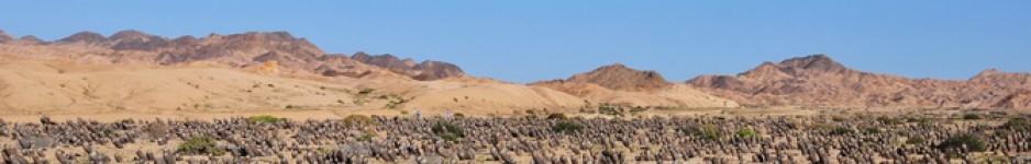
It was time to start the journey back to Long Beach. Getting up was hard until my pain killers kicked in to dull the back ache. An early stop (S1283), along the Old Spanish Trail Highway, allowed the muscles to relax a little. Echinocactus polycephalus with the early morning sun bouncing off its spines, made me forget any pain, at least until the first ground squirrel den collapsed below my feet and sent a jolt back up the spine. No pain – no gain! Ferocactus cylindraceus‘ yellow spines provided the gold to complement the silver of the E. polycephalus spination against the multicoloured rocks. Opuntia basilaris, Yucca schidigera were also present in a stunning scenery.
S1284 found us back at the Excelsior Mine Road where on 23 February we made a series of short stops, all grouped under S1276. One of these brief stops was this exact spot! The reason that we were back was that this time that Eunice had a precise GPS location for Agave utahensis
That day, we had learned that sometimes flower stalks are cut off to harvest seeds, so instead of ‘stalking’ them, we had to find another way to find these plants – spreading out (all three of us!) and exploring on foot. Notes and GPS data suggested that we should explore to the south of the road, where there were lots of massive Nolina parryi. Regular readers of this Diary will have become used to my poor spelling, often caused by poor light conditions, as I type up notes early in the morning, and don’t want to switch on a light and wake up Cliff, while in the evening my eyes are tired and dry, or streaming with tears caused by irritation of cleaning materials used at our Motels. However, here spelling matters as in conversation I readily confuse Nolina with Nolana, a genus of plants commonly found in Chile and Peru. The exact position of Nolina is also confusing, sometimes it is placed in Agavaceae, sometimes in Nolinaceae, or Ruscaceae or in Asparagaceae. So please use whatever you feel comfortable with.
Just to be clear, Wikipidea (a convenient but not necessarily authoritative source) says: ‘
Nolina parryi (Parry’s Nolina or Giant Nolina) is a flowering plant in the family Ruscaceae, endemic to Joshua Tree National Park and the Kingston Range in the Mojave Desert in California. It grows to 0.3-2.1 m tall, as high as 4 m when in flower, with a trunk up to 60 cm in diameter, and a dense head of 65-220 spirally arranged, linear leaves 50-140 cm long and 2-4 cm broad. It is dioecious, with separate male and female plants; the flowers are white, produced on a tall plume-like flower stalk that normally appears in late spring.
While we enjoyed taking pictures of these giant Nolinas, and Cylindropuntia echinocarpa, Echinocereus engelmannii, Ferocactus cylindraceus, Opuntia basilaris, O. erinaceae ssp ursina and Yucca schidigera (renamed ‘shin digger’ by Cliff, who has the scars that prove the point), Agave utahensis remained illusive. Until Eunice shouted that she had found it. Standing next to the car?!?!
Cliff & I scrambled back down the hill to see what all the excitement was about, and Eunice explained that if we looked up a narrow canyon on the other side of the road, we’d see a limestone hillside in the distance, with at the top the flower stalks of our target plant. The painkillers were working fine and while Eunice and Cliff were still deciding the best route, I was half way there already, stopping every now and then to take pictures, catch my breath and plan the next 10 steps forward, getting ever closer all the time. Then a shout from Eunice – she had found a Dudleya! Most unexpected for me, as I tend to associate these plants with Pacific Oceanside habitats. But ten steps later, I stumbled across one as well! To this, add all the species from across the road and add Agave utahensis at the top of the hill (S1285).
Cliff had climbed up the other side of the canyon and found the same plants there. Plotting the location on Google Earth helps to identify the limestone hills in satellite view, so should make it easier to find further locations for a future visit. I’m not sure if the plants we found were subspecies eborispina or not, I’ll have to do some reading to discover how they are supposed to differ, but they were nice plants, as long as you ignored the ones with the flower spikes that had guided us to the location, because they were of course, dead.
Back on Excelsior Mine Road, we reached the remains of the Excelsior mine and made a fortunate wrong turn, because right along the side of the road were limestone hillsides and no more than ten yards from the car grew Agave utahensis. I admit that I enjoyed the fun of the chase for the previous finds, but this one along the road (S1286) was very welcome for my back, as it had begun to cease up again after 10 minutes or so in the car. One more surprise: as well as the omni-present Echinocereus engelmannii there was also E. mojavensis, now E. triglochidiatus ssp mojavensis, having also been regarded as E. coccineus ssp mojavensis. No wonder that plants in habitat are not labelled – some one would have to go round changing all the names each time that a botanist changes them. Mind you – not a bad job, to be paid as ‘botanical label changer’, or even better: ‘botanical label changer inspector’! This was the only location where we saw this taxon.
My mid day painkillers were over due, so, after taking them, I think I dozed for most of the way to a stop in the Clark Mountains. Here we were supposed to see Agave utahensis ssp nevadensis. By now we were experts at Agave stalking and once the GPS said we were there, we found ourselves surrounded by hillsides full of them, but each required another formidable climb. But, needs must – so before too long we had reached the ridge of the hill, only to be almost blown back by the strong wind. (S1287). Wikipedia says of the Clark Mountains:
The Clark Mountain Range is located in eastern California, north of Interstate 15 and the community of Mountain Pass. The ranges stretches approximately 15 miles (24 km) in a southwest-northeasterly direction, beginning in the Mojave National Preserve, and ending near Stateline Pass, about one mile (1.6 km) from the Nevada border. Clark Mountain, at 7,929 feet (2,417 m) above sea level, is the principal peak of the range. The foothills of the range are in creosote scrub and Joshua tree forests, which adjoin the dense Joshua tree woodlands atop Cima Dome. Higher up, pinyon pine and juniper grow on the “sky island” which occasional rains create above 6,000 feet (1,800 m). The north side of the crest contains a small forest of white fir trees, which is extremely difficult to reach. Clark Mountain is one of three mountain areas where these rare trees persist; Kingston and New York Mountains are the other two areas where the Rocky Mountain white fir can be found in California.
The small town of Mountain Pass, CA, is located at the foot of the range. The Moly Mine Corporation mines rare elements from the mountain, including radium, cadmium and other metals. Attempts to transport the mine waste out of the area have resulted in several toxic spills. The range contains Keany Pass and the Umberei Mine.’
As well as all the previous listed taxa, Yucca brevifolia had re-appeared. ‘Why is it called the Joshua Tree?’ we asked ourselves, and have been asked, so a quick search on Google suggests:
The name Joshua tree was given by a group of Mormon settlers who crossed the Mojave Desert in the mid-19th century. The tree’s unique shape reminded them of a Biblical story in which Joshua reaches his hands up to the sky in prayer.
The surprise here was Echinomastus johnsonii (I think). ID to be confirmed.
S1288 was ‘Another-bloody-sunset’. This one started soon after S1287, with the low sun playing on the power lines of Powerline Road. It continued as the sun sank lower as we drove along I15 to Barstow. It is the only series of sunset pictures to date, taken over such a long distance and mostly at around 70 miles per hour.
Tomorrow we return to Long Beach.