We agreed that today we would focus on finding Geohintonia mexicana and Aztekium hintonii. Our database had GPS coordinates to show that these two species shared the same habitat. The coordinates were not on any road that the SatNav system knew about. It sent us south along Highway 61 and suggested that just before Pablillo we should look for a couple of tracks east. All very well doing this armchair exploring, but it hardly prepares you for what you see. Yesterday proved that roads marked on maps as being of similar standard can vary immensely and that recent weather events can seriously change matters. Even road numbers change. What was marked as Highway 61 today used to be Highway 2 and is still marked as such on some roadside signs.
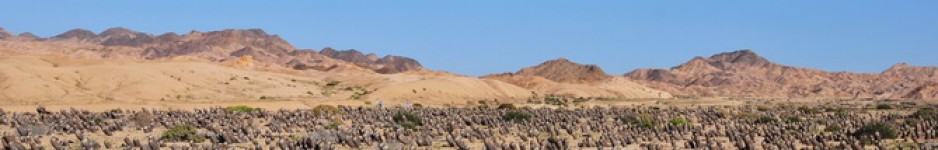
So it was good to find that today’s road was in tip top shape, apart from two short sections that needed to be scheduled for wear and tear repair work. We soon reached Pablillo and started our search for the expected track east – to no avail. Where SatNav showed a turning there was none. Where we found tracks, they took us through agricultural fields to dead ends at the foot of the snow white chalk hill sides. From there it became clear that our target plants must grow on the other side of the hills that we were looking at – far too far to hike.
What to do? Highway 61 leads to La Ascension and our records showed that there is a location for Ariocarpus retusus near the town. We decided to see what the road was like and to take a look around the town to see if there were hotels (no), Pemex stations for fuel (no) and banks (yes). It also boasted a couple of small pretty churches that were photo graphed. (S2281). But I run ahead of myself.
We had been seeing small shrub-like cacti along the road. An early toilet stop (S2278) confirmed that these were Cylindropuntia tunicata in really good shape. We took a few pictures and had hardly moved on when we screeched to a halt again, this time for a clump of Echinocereus. Both stops were so close together and with similar plants that pictures for both are filed under S2278. We found Agave asperrima (s.n. A. scabra), A. gentry (or was it A. montana?), Cylindropuntia tunicata, Echinocactus platyacanthus, Echinocereus parkeri, Opuntia rufida and another Opuntia sp., Thelocactus buekii, pulled deep into the soil, Tillandsia sp. in the trees and impressive specimen of Yucca faxoniana (s.n. Y. carnerosana).
S2279 was the point where we turned around at Pablillo. We found Opuntia and Cylindropuntia used to support the fences.
S2280 was at the foot hills, walking through white talcum-powder-like terrain. The tree like Yucca faxoniana was here and a few Cylindropuntia tunicata, but not much else. S2281 was the no plant stop in La Ascension, already mentioned.
Back on Highway 61 heading back towards Galeana, SatNav soon told us that we were at the Ariocarpus spot. This was a John Miller spot and usually his data is spot on, taken from the plant rather than from the car park from where you find the plants. There was the usual barbed wire fence along the road and we had to be some 400 m. in from the road. But wait – it seemed that there was a narrow path between two fenced off areas. I followed the path. Eunice followed, but stopped at the point where the GPS told her to cross the fence and head for the top of the low hill (Hill #1). I was already at the end of the path that opened up to another area that had been grazed by cattle and donkeys and was half way another low hill (Hill #2) when I spotted the first A. retusus, and the second and the third, fourth etc. It was difficult to stand in one place without stepping onto the Ariocarpi of all sizes. They provided a good example of how variable this species is in terms of tubercle shape. Eunice quickly responded to my excited shouts.
There was much more to see than just Ariocarpus: Agave asperrima (s.n. A. scabra), two Cylindropuntia sp., Opuntia sp. Echinocactus platyacanthus and some small Echinocereus parkeri and many Thelocactus buekii, again pulled right down into the soil. We spent a good hour taking hundreds of images. Time to move on. As we walked by Hill #1, there was a nice clump of E. parkeri beckoning us to cross the fence. We had assumed that the vegetation here would be the same as hill #2. Wrong. There were many more A. scabra here. We walked to the exact JM coordinates but strangely did not find any Ariocarpus until we were right on the coordinates and then only found a dozen plants. Here were also some Neolloydia conoidia and as a final bonus, two large clumps of Ferocactus pilosus, the last one with four heads in flower. What a great location!
On the way back we stopped at another JM location (S2284). This time for Echinocereus knippelianus. But this time the plants must have died since their visit some ten years ago. There were some large Agave here, A. gentryi or A. montana. And Thelocactus bueki was also still here – very wide spread.
Time was moving on, so we headed back to Galeana, but at the major crossroads south of time I spotted a dirt track that seemed to lead straight into the valley the other side of the range where we had been. This HAD to be the way to Geohintonii. We followed the track for some 8 km and SatNav confirmed that we were heading straight for the honey pot. So we know what we’ll be doing tomorrow!

Leave a comment